Hi there! 😊
Since the human is a creature of habit, DF and I couldn't fight the addiction and started another time towards the mountains at Friday, the 13th of July 208. And even if the packing before has become a routine, I was still not used to my room looking like I was in the middle of moving. 😅
 |
| Moving?! |
Our goal this time was the Ehrwalder Sonnenspitze ("Ehrwald's Sun Peak") with 2.417 m. It is practically vis-à-vis with the Tajaköpfe and wears the nickname "Ehrwald's Matterhorn" - not without good reason. I have to admit that the Sonnenspitze looked absolutely unconquerable when I looked at it from a distance. So, it was understandable that we were a bit nervours...
 |
| You see right in the middle the unconquerable looking Ehrwalder Sonnenspitze |
The day of bad luck (Friday, the 13th) had a nasty obstacle for us - a traffic jam of about 15 km near Würzburg. So we had to drive (again) through the countryside to pass Würzburg and reach the highway A7. Despite that adversity, we reached our already known parking space behind the little chapel in Ehrwald at the late evening. We still had the time for a short walk and witnessed some beautiful views.
 |
| Wetterstein mountains in the afterglow |
 |
| Vorderer Tajakopf in the afterglow |
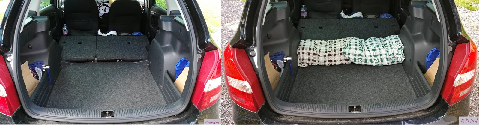
Since some people had asked how DF and I could sleep in the trunk and if that was not extremely uncomfortably, I took pictures of our sleeping patent for you:
 |
| 1. Empty trunk 2. Covers for one set of one table and two benches |
 |
| 3. Mattresses |
 |
| 4. Blankets |
 |
| 5. 3 Stoffel 😋 |
And yes, it's comfy. 😜
Our alarm rang at four o'clock at Saturday morning - hobbies can be hard sometimes.
The first stage was (like two weeks ago) the Seebensee but we ascended via the Hohe Gänge ("high trails") this time. It's a black hiking route (most difficult one) which is sometimes mentioned as a ferrata. I think there are not enough secured passages to count it as a real ferrata.
The trail started in steep serpentines up in the forest until we got closer to the wall, which lies below the impressive high plateau. The sky was not looking too friendly at this time: the clouds were getting darker and it looked like it mithgt start to rain anytime.
 |
| Ominously looking sky...😨 |
We reached the first rocks in form of a scree fielt at 06:05 am. The trail only passed it for a short while and so we reached the Coburger bench half an hour later. I had never seen a corner bench until then up in the mountains - but I could get used to it. 😁 ...the moment when we arrived at the bank, the rain, which had been signalized by the huge misty wall in the distance, reached us. We waited for about 15 minutes under a tree until we began to ascend via the Hohe Gänge.
 |
| Scree field at the Hohe Gänge |
 |
| Coburger bench |
I knew that route from an ascent two years ago and already thought it was uncomfortable back then. Now, right after a squall, the rock was slippery and just nasty to walk on. The trail wriggles upwards in adventurous serpentines. The highlight was a grid that had to replace some of the missing trail. It did not look very reliable...
 |
| DF behind bars...uhm, on the grid 😁 |
 |
| Hohe Gänge with steel ropes |
We reached the end of the Hohe Gänge at 07:20 am and comfortably walked on on the broad path towards the Coburger hut. The blue sky was shining through from time to time at this point.
 |
| A bit of blue sky |
Our path lead us past the Coburger hut, which we reached at 09:00 am. We didn't stay for a long time and marched on towards the Bieberwierer Scharte ("Bieberwierer wind gap"). We found a nice shady spot along the trail where we stopped to have breakfast - and to strengthen ourselves for the next challenge.
 |
| Forest of signs at the Coburger hut |
 |
| The Sonnenspitze - up on the left and down on the right side. It sounds so easy... |
 |
| View during our breakfast |
The entry for the route was signposted well and we reached it a short time afterwards. From this point on, there were only red marks or cairns leading the further way. I suggest to look for the cairns or stands because the red marks are often heavily faded out. The stands were rather easy to see because the steel reflected the light and built a contrast to the stone. All in all, there were enough markings but one had to keep his/her eyes open.
DF documented the complete trail in his video. I will try to describe it as good as possible. It's a good memory aid when you try to remember that you have to climb/hike to the right or right upwards. The trail only leads to the left right after the crux but that point is well marked with a steel rope.
Never forget one thing during the tour: Take a rest from time to time and enjoy the wonderful views! You could forget it while climbing. 😅
Back to the actual trail: We followed a clear path passing some mountain pines (I am haunted by them!!! 😱), trackways lead over a scree field. There might be better ground for walking but we also had had worse...
 |
| Scree field with visible trackways |
The trail lead to the right over several rock ledges but it became stonier with every further step.
 |
| Trackways in the middle of the picture |
We followed the visible trackways until we found a stand upwards on the left side and a red arrow on the right side to it - leading into the first draw.
 |
| Draw right up |
 |
| View back in the draw from above |
We followed that draw up until a red marking and a cairn signaled to leave it to the right side and follow a small trail.
 |
| Traverse up on the right side of the draw (arrow = cairn) |
The trail ended in solid rock. You could climb the direct way or in another draw. Walking and climbing areas changed like this all the time, so it didn't get boring for DF and me.
 |
| Choice between rock or draw |
 |
| "Walking area" on small trails |
 |
| View to the Tajaköpfe, the Drachensee and the Vordere Drachenkopf |
Unfortunately, we had to pass a draw, which DF would have loved to climb up - the arrow had its own words. The disappointment didn't take long because another draw including the crux was already in front / above of us. There was even a foothold so one could get up.
 |
| Arrow towards the crux |
 |
| Draw lover DF 😋 |
 |
| Foothold in the crux |
We had to turn left afterwards and followed a steel rope. That part is secured because a person had fallen into death some years ago - the trail was so exposed that we could understand that quite well.
 |
| Follow the steel rope to the left |
 |
| Trail next to the steel rope (arrow) |
 |
| Panorama climbing |
We took a turn to the right at the edge and followed the already know pattern.
 |
| DF in his element |
 |
| Katharina and the Wamperter Schrofen on the left |
A rather relaxed walking part followed by exposed traverse were the next part of our route. One should avoid any mistake there! Further cairns lead the way and we could traverse over a ledge.
 |
| Traverse at the rocks |
The markings became less from this point on and we had to trust our instincts. Since we had only 50 height meters left, we thought that we couldn't make too many mistakes anymore.
We climbed over the next edge and looked at the main summit with the summit cross at 12:00. 😎
 |
| Summit panorama with the Wetterstein mountains (on the right side) |
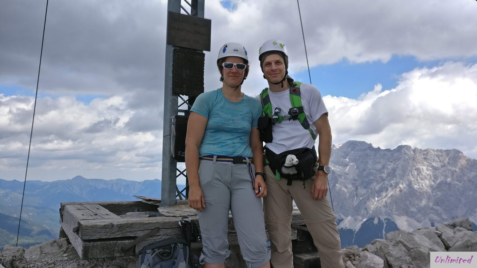
We had a short break to take some pictures at the subsidiary summit at 2.417 m. We had a great 360 degree view and could already see the small ridge connecting the main and the subsidiary summit.
 |
| Team Stoffel at the subsidiary summit of the Sonnenspitze |
DF had so much fun walking on the ridge that he walked it three (!) times. Once so I could film him, another time to exchange the camcorder and a third time to finally reach the summit cross. That is what I call a total commitment for the arts. 😂 ...besides that, he had a lot of fun of jumping around on the ridge. His nickname was not chosen by chance...
 |
| DF on the other side of the force |
 |
| Ridge walk |
 |
| Fun à la DF |
 |
| Fooling around on the ridge |
 |
| After the third time |
 |
| Katharina waiting on the other side |
We had a short break at the summit. It even began to rain during that time (for a change...?) and we began to descend.
 |
| Three Stoffel at the Sonnenspitze |
 |
| Yuck, rain! |
 |
| Tajaköpfe with Seebensee and Drachensee |
The north side was covered in gravel and thanks to that very demanding - but we also had slippery rocks due to the great weather. Whoever had tried to find grip on soap will exactly understand what I mean...
 |
| Descent with gravel |
We had to keep our eyes open to see the marking for the way down and the trackways were also rare. We needed about one hour to descend only 100 height meters. What a dream...
 |
| Tricky, tricky... |
The area became more comfortable to walk on and offered great motives for taking pictures.
 |
| It became easier from here on... |
 |
| ...but that was the final obstacle... |
 |
| Fun during the descent |
We put away our helmets and hiking sticks after a third of the way done. The area changed and became a lot easier. The weather gods meant it well for us at this time. It looked like the end of the world but it was stopped at the Tajaköpfen while we had wonderful sunshine only a few hundred meters farther.
 |
| Who had ordered the end of the world?! 😱 |
It thundered in the Reintal not too far away from us and finally it also rained down on us. We still were lucky because the rain only stayed with us for about 15 minutes. The rocks were slippery afterwards but the area was luckily easier to walk on.
We reached the broad way close to the Seebensee at 04:20 pm. It would have been possible to descend quicker but we were not in a hurry.
We chose the Immensteig again for the further way since we were not in the mood for slippery Hohe Gänge. And DF still had some energy left during the descent...
 |
| No comment... |
We were completely exhausted when we arrived at the car after 13 hours and 1.400 meters up and down at 06:45 pm.
Conclusion for the tour:
Wow! Just wow! There are not many routes about which I would say that I would go them a second time but the Ehrwalder Sonnenspitze is one of them (just in case, if we might run out of new goals in the future 😇)!
It was my first climbing tour in solid rock (not like at the Friederspitz where we had to play "Jenga" against the ridge...) and it was a real event. I was not fully used to it yet but I think that I might get to like it.
The Ehrwalder Sonnenspitze's rock is comfortably solid at the south side. The north side is contrary to that covered in gravel. The real crux begins after the summit and not before.
I suggest to start early for that tour because it is quite popular despite its difficulties. It's not rare that real caravans hike up there. DF and I were lucky and met less than 20 people during our ascent and descent. We were on the Tajaköpfen two weeks before and had a great view towards the summit of the Sonnenspitze. The crowds were sooo massive up there back then that it reminded us of some super summer sale in a market. 😮
Magnificent sunshine is not mandatory for the tour because the sun will bake you on the rocks. Some clouds are really helpful and make it easier to climb on.
I would also recommmend to wear a helmet because little stones might always fall down even if the rock is mostly solid.
The tour is not advisable for beginners because the approach and the descent lead over black routes. Whoever wants to try some very nice rock climbing will have a joyful day at the Ehrwalder Sonnenspitze.
See ya 'til the next mischieve!
Your Katharina


Keine Kommentare:
Kommentar veröffentlichen